
As Super Typhoon Bavi lashes Japan’s Ishigaki Island with violent winds and floods, it also shows how fast real danger and online confusion now collide during major storms.
Story Snapshot
- Typhoon Bavi is pounding Ishigaki with heavy rain, strong winds, and dangerous seas.
- Japan’s weather agency warned of extreme rainfall, huge waves, and storm surge across Okinawa.
- Flights and ferries are shut down as residents hunker down and brace for damage.
- Early online reports about the storm’s exact path highlight a growing problem of disaster misinformation.
Typhoon Bavi slams Ishigaki with severe wind, rain and waves
On Saturday morning, Typhoon Bavi pummeled Japan’s southern island of Ishigaki with violent winds and heavy rain, turning streets into rivers and pushing waves deep into harbors. Live coverage from international media shows palm trees bending, debris flying, and visibility dropping as sheets of rain pound the island. Local video from the port area captures plant pots and other fixtures smashed by the wind as the typhoon’s core passes nearby, underscoring how even a short hit can cause real damage.
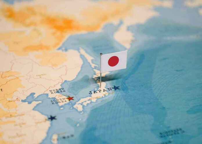
Japan’s Meteorological Agency classified Bavi as a large and very strong typhoon as it moved west-northwest toward the Sakishima island chain, which includes Ishigaki. Forecasters warned the storm would bring violent conditions to the wider Okinawa region through July 11, with the worst weather striking between July 10 and 11. Satellite images shared by news outlets show the typhoon’s swirling cloud mass covering much of the East China Sea, with Ishigaki sitting close to the zone of strongest winds and rain.
Authorities warn of extreme rainfall, storm surge and travel shutdowns
Japan’s Meteorological Agency forecast up to 250 millimeters of rain over Okinawa in just 24 hours from midday July 10, with another 100 millimeters likely in the next day. That much water in such a short time can overwhelm drains, trigger flash floods, and cause landslides in steep terrain. The agency also warned of wave heights up to 13 meters around Okinawa on July 10 and 11, with storm surge threatening low-lying coastal areas and ports. These conditions can destroy seawalls, flood warehouses, and cut power to entire communities.
In response, local officials and transport companies shut down flights and ferry services to and from Ishigaki for all of Saturday, effectively isolating the island while the storm passes. Residents had already spent days taping windows, securing signs, and moving outdoor items indoors after national and international outlets flagged Bavi as possibly the region’s most destructive storm in years. Fishing boats were tied down or moved to safer waters, and tourists were urged to stay indoors and follow evacuation or shelter guidance if given.
Forecast differences and online noise add confusion during real danger
Even as the physical threat to Ishigaki became clear, forecasts were not perfectly aligned on the storm’s exact track. Some detailed weather reports said Bavi would pass between the Miyako and Ishigaki island groups before heading toward China’s Zhejiang and Fujian coasts, meaning Ishigaki would be hit hard by outer bands rather than a direct eye landfall. Social media posts and live “storm chase” streams, by contrast, often described a direct “intercept” or landfall on Ishigaki, using dramatic language to capture attention and views.
Clean-up happening rapidly on Ishigaki, Japan after relatively minor impacts from Typhoon Bavi. However, a level 2 flood risk and level 5 wave risk are in place for the island today as feeder bands are dumping heavy rainfall @accuweather pic.twitter.com/pPZcWtJGrT
— Reed Timmer, PhD (@ReedTimmerUSA) July 11, 2026
Research on disaster reporting shows this kind of divergence is common in the first days of a major storm, when both newsrooms and influencers race to publish eye-catching content before full data is available. Studies of past hurricanes and floods have found that many early stories focus on dramatic images and possible death tolls while giving less space to calm, verified information on warnings and safety steps. Scholars also note that misleading posts can spread fast, creating confusion about which areas face the greatest danger and what people should actually do.
What this storm reveals about trust, preparedness and “elite” systems
For people watching from the United States, Typhoon Bavi’s impact on a small island far away still feels familiar. Islanders secured homes days in advance and followed clear guidance from local officials, yet they still depended on large national agencies and international media to tell them how bad the storm might get and where it would go. At the same time, eye-catching clips and extreme claims online competed with official forecasts, making it harder for families to know whom to trust in a crisis.
Many Americans already feel that distant “experts” and powerful institutions talk at them, not with them, whether about storms, budgets, or borders. Disaster researchers warn that when people lose trust in official information, they may turn to rumors or conspiracy theories about things like “steered” storms or hidden damage numbers, even though agencies like the National Oceanic and Atmospheric Administration have clearly debunked claims that governments can create or steer hurricanes. Bavi shows how vital accurate, plain-language warnings are, and how quickly mixed messages can feed the wider belief that systems run by elites are failing ordinary people when danger strikes.
Sources:
youtube.com, dailymotion.com, sea.weathernews.com, instagram.com, facebook.com, poynter.org, brookings.edu, ross.house.gov, tandfonline.com, noaa.gov
© patriotwise.com 2026. All rights reserved.