

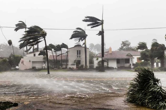
A Category 5 hurricane with winds near 165 mph is churning just off southwest Mexico, threatening life‑threatening flash floods and mudslides this week.
Story Snapshot
- National Hurricane Center classified Polo as Category 5 with extreme winds.
- Rapid intensification vaulted Polo from a tropical storm to a top-tier cyclone in about a day.
- Heavy rain is forecast to pound coastal southwest Mexico through Thursday.
- Forecasters expect the core to stay offshore, but hazards on land remain serious.
What forecasters say Polo is doing now
National Hurricane Center advisories on September 22 said Hurricane Polo reached Category 5 strength on the Saffir–Simpson scale. The agency reported maximum sustained winds near 165 miles per hour with higher gusts. The storm’s core is tracking near the coast of southwestern Mexico and is forecast to remain offshore. That track reduces direct wind risk onshore but does not remove the danger from rain, surf, and rip currents along the coast.
Forecast discussions from the National Hurricane Center emphasized heavy rainfall for coastal southwest Mexico through Thursday. Mountains near the coast can squeeze more rain from the storm’s bands. That setup raises the risk of flash floods and mudslides even without a landfall. Residents in low spots and near steep slopes face the greatest danger if rain bands stall or repeat over the same areas.
How a tropical storm became a Category 5 so fast
Media reports, drawing on National Hurricane Center data, described an extreme burst of strengthening from a 50 mile per hour tropical storm to a Category 5 hurricane in about twenty‑four hours. That jump meets the standard definition of rapid intensification used by forecasters. Warm water, moist air, and low wind shear can flip a switch for storms and speed up how fast winds rise, which appears to have happened with Polo.
Some outlets cited peak sustained winds as high as 180 miles per hour based on aircraft and satellite estimates. National Hurricane Center advisories around the same period listed winds near 165 miles per hour. During fast‑changing events, numbers can differ by update cycle and method. The agency’s formal best‑track report after the season will lock in the final peak intensity and timing.
What this means for people along the coast
Coastal states in southwest Mexico should prepare for torrents of rain, sudden floods, and landslides through midweek. Even if the center stays offshore, outer rain bands can dump many inches of water in hours. Rivers and dry washes can rise quickly with little warning. Emergency managers often urge people to avoid crossing flooded roads, move to higher ground when heavy rain begins, and follow local alerts and evacuation guidance as conditions shift.
🚨 Hurricane Polo Update: One of the strongest storms ever is churning off Mexico’s Pacific coast, raising concerns as it intensifies. 🌊🌀 Get the latest details, track the storm and see what’s next 👇 https://t.co/Wh4tN1phOA #HurricanePolo #Mexico #Storm pic.twitter.com/Tx8pZd6U16
— La Amelia (@LaAmeliajo) September 23, 2026
Power outages and road damage are also possible where soil loosens and hillsides give way. Fishermen and port operators face dangerous seas and long‑period swells. Communities already dealing with tight budgets may struggle to clear roads and restore services fast. When warnings are timely and clear, families can act sooner. Clear alerts help cut the human toll even when storms stay just offshore and winds at the coast are below the roaring core.
Why the “historic” label grabs attention
Reporters called Polo one of the strongest eastern Pacific storms on record after its leap to Category 5. That framing reflects the storm’s rare top strength and the speed of the jump. Official bulletins focus on precise numbers, locations, and hazards. Both can be true at once: the science stays careful, and the public hears superlatives. Either way, the takeaway is simple for people in the path: heavy rain is the main threat, and it is coming soon.
Sources:
nypost.com, nhc.noaa.gov, cnn.com, weather.com, en.wikipedia.org, foxweather.com
© patriotwise.com 2026. All rights reserved.